
")
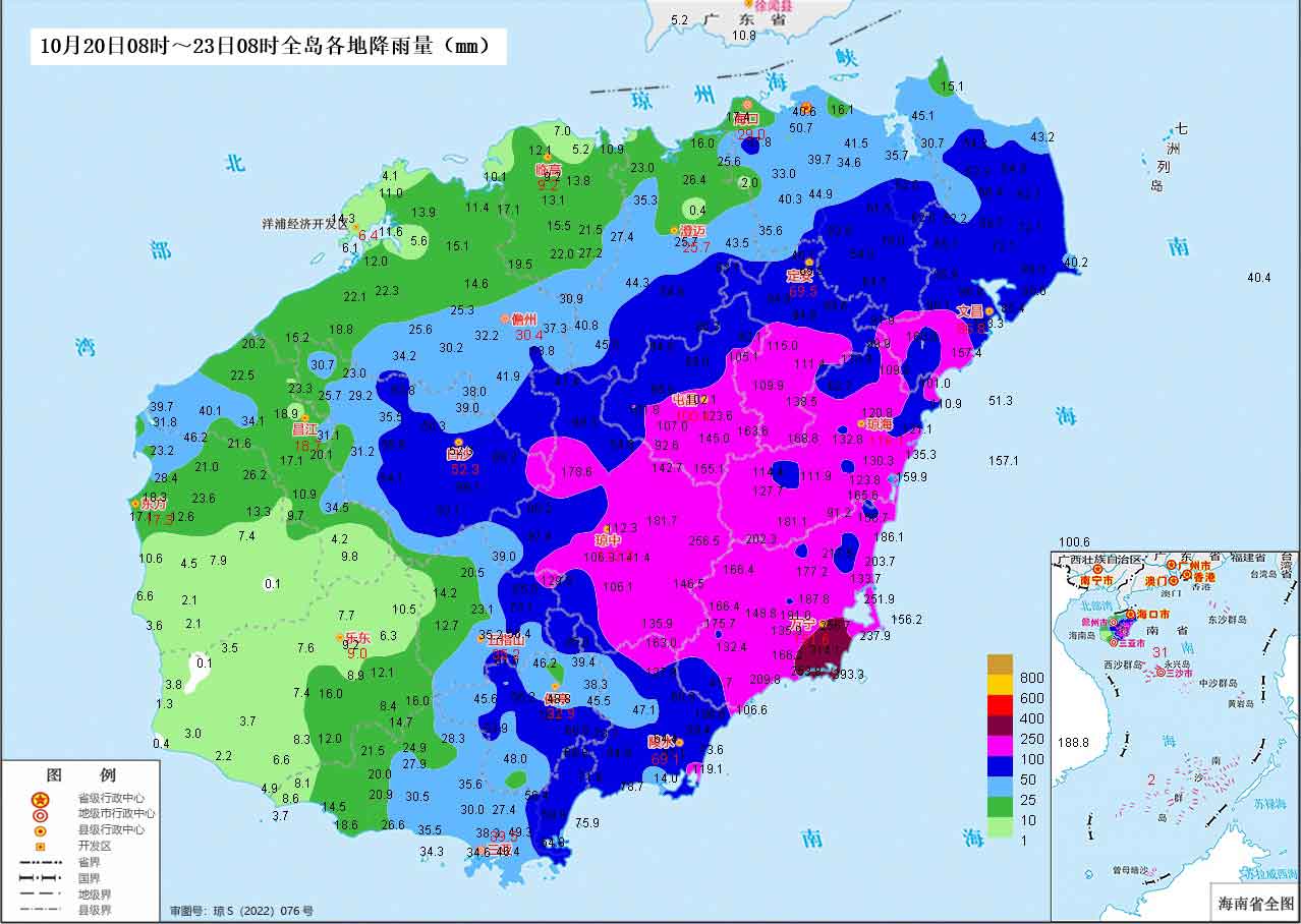
If you’re planning beach time, boating trips, or outdoor adventures in Hainan this week, you may want to hit pause. The latest forecast from the Hainan Meteorological Bureau indicates a stretch of unsettled weather, with heavy rainfall and strong winds expected across the island and surrounding seas from October 23rd through 31st.
What to Expect
October 24–25 (daytime): A brief window of relatively dry weather, mostly cloudy skies with only scattered light showers in central and eastern regions. Highs will rise to 24–28°C, with lows between 17–22°C, depending on your elevation.
October 25 (night) to 31: The rain returns. Most of the island will see light to moderate rainfall, with localized heavy to torrential rain especially in the east and central interior. Temperatures will trend warmer: daytime highs of 26–30°C and nighttime lows of 20–24°C.
Marine warning: Conditions may be hazardous for small and medium-sized vessels. If you’re sailing, kayaking, or operating recreational boats, check real-time wind updates and advisories. Operators of island-hopping ferries and dive tours should be prepared for possible weather disruptions.
Good News: No Drought
Despite the dramatic rain and wind, there’s no meteorological drought across the province as of October 22. Conditions remain stable compared to earlier in the month.
Quick Tips for the Week
Dress in layers: Early in the week, mornings and nights, especially inland or at elevation, may feel chilly. Temperatures will climb gradually after the 25th.
Stay alert if boating: Winds will remain strong on all coasts until the end of the month. Check the marine forecast before heading out.
Flood-prone areas: If you live in or commute through low-lying areas, expect potential flooding during heavy rainfall days, especially in the east and central regions.
Watch for traffic disruptions: Rain may affect road conditions, particularly during evening commutes.
Related article: La Niña is Back — Here’s How It Might Shape Hainan’s Winter