

Hainan is bracing for heavy rain, strong winds, and possible flooding as Typhoon Wipha moves closer to the island this weekend.
The tropical system, which developed into the year’s sixth named storm early on July 18, is currently located about 510 kilometers northeast of Manila in the Philippines. It is moving northwest at 20–25 km/h and is expected to strengthen further, potentially reaching typhoon or even severe typhoon intensity before entering the northern South China Sea early on July 19. From there, it will track toward the coastal areas between central Guangdong and eastern Hainan.
What to Expect
When:
July 19: Strong winds and scattered showers begin.
July 20–22: The worst conditions expected, with heavy rain and powerful gusts.
Rainfall:
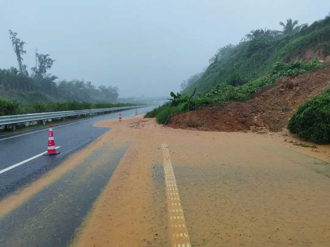
Most of Hainan will see heavy to torrential rain, with the north and west facing the heaviest downpours, potentially “extremely torrential” in some areas.
Localized flooding, landslides, and swollen rivers are likely.
Winds:
Coastal areas in the north, east, and west may see winds reaching Force 10–12 (up to 120 km/h).
Southern coastal areas can expect slightly weaker but still dangerous winds at Force 8–10.
Impact on the Sea:
South China Sea (northern and central areas, including near Zhongsha Islands): Winds increasing from Force 5–6 on July 18 to Force 10–11 with gusts up to Force 14 through July 22.
Waters around Xisha Islands, Hainan’s coastal waters, and Beibu Gulf: Similar strengthening winds expected July 20–22.
Nansha Islands: Moderate winds, but thunderstorms could bring sudden gusts up to Force 9.
Travel and Safety Advisories:
Maritime & Ferry Disruptions: Ferry services across the Qiongzhou Strait are likely to be suspended for extended periods from July 20–22. Ships, fishing vessels, and offshore platforms are being told to return to port or secure shelter as soon as possible.
Urban & Rural Flooding: Northern and western Hainan face a high risk of flash floods, landslides, and road washouts.
Residents should avoid low-lying areas and be prepared for possible power and transport disruptions.
Infrastructure & Tourism Risks: Authorities are urging inspections of reservoirs, drainage systems, construction sites, and tourist facilities. Travelers should monitor local updates and adjust plans accordingly.
Stay Informed:
Local authorities are on high alert and coordinating flood control, transportation, and emergency response. Residents and visitors are advised to follow official updates closely, avoid unnecessary travel during peak conditions, and prepare for potential extended delays in transportation and services.
Related article: Essential Contacts details for Emergency services in Haikou