

Wednesday 27th, The China Meteorological Administration issued the highest-level typhoon alert, elevating Typhoon Doksuri’s landing intensity from the previous “strong typhoon-level” to “super typhoon-level”.
Doksuri is expected to make landfall in China on Friday 28th, the second typhoon to land in under two weeks after Talim slammed into Guangdong on July 17th.
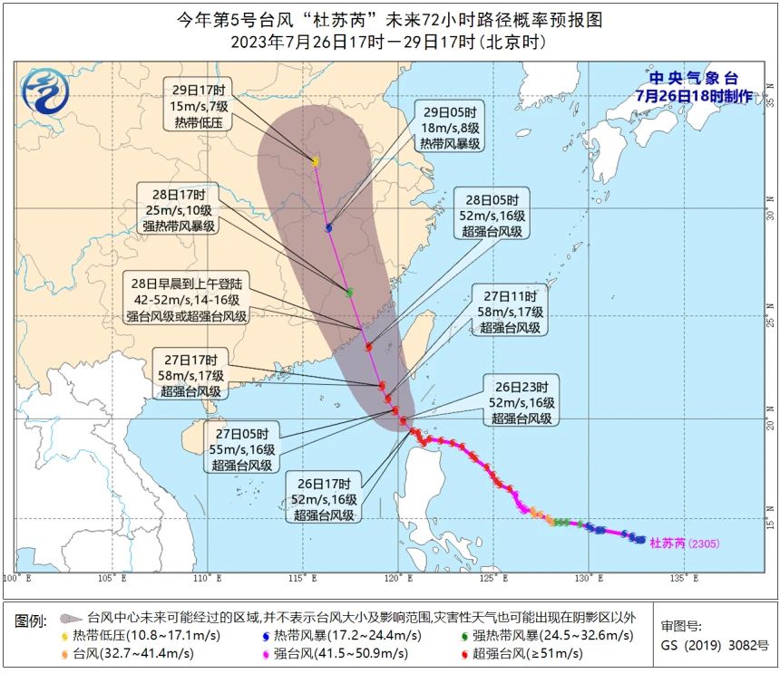
The Predicted landing area is along the coast from Jinjiang, Fujian to the junction of Fujian and Guangdong provinces. The typhoon is expected to make landfall as a strong or a super typhoon, with wind speeds of 45-52 meters per second (14-16 on the Beaufort scale).
The storm, labelled as a super typhoon by China’s Meteorological Administration, is nearly 900 km (560 miles) across and is expected to sustain strength as it continues towards the Chinese mainland.
China’s weather agency has already raised its storm alert to the second-highest tier and Guangdong province has been warned it may be the worst storm in a decade.
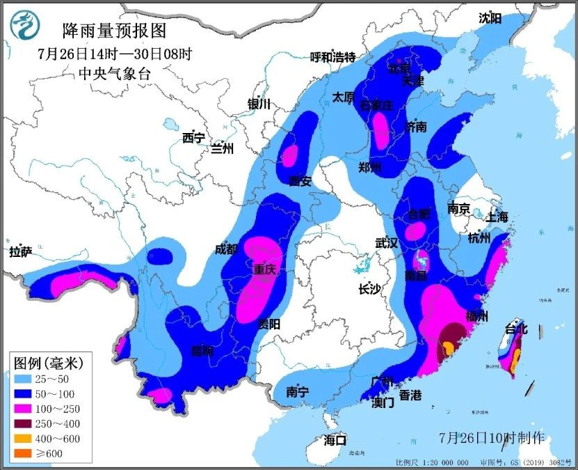
Doksuri is expected to have a wide and prolonged impact, and it may penetrate deep inland after making landfall, leading to an expanded affected area. China upgraded its emergency response from Level III to Level II, which implies the oncoming typhoon could severely affect the entire country, according to the State Council’s national emergency plan for flood control and drought relief.
From the 26th to the 28th, some areas in the eastern parts of Southwest China, eastern parts of Northwest China, North China, and the Huang-Huai region will experience moderate to heavy rain. In localized areas, there may be occurrences of heavy rain to severe heavy rain.
Related article: How does a typhoon form?