")
An Historic Delay in the Northwest Pacific
By June 2025, not a single typhoon had formed in the Northwest Pacific, a rare situation that’s occurred only six times since 1950. The average first storm usually forms by late March. That we’ve passed this date by more than two months with no activity marks a significant meteorological anomaly.
This delay is not just local. Storm formation has been slow across the entire Northern Hemisphere. Aside from Tropical Storm Alvin (Eastern Pacific) on May 28, 2025, most Northern Hemisphere basins had been slow.
Note however, that the North Indian Ocean had already seen unnamed tropical storms ARB 01 (May 24–25) and BOB 01 (May 29–30).
Hainan’s Unseasonal Calm

For residents of Hainan, this has meant an extended period of stable weather. Typically, by late spring, the island is preparing for at least the threat of early-season typhoons. Instead, 2025 has delivered hotter, more humid days, without the heavy rains or storm disruptions that normally accompany this time of year.
Farmers and fishermen have enjoyed short-term benefits. The absence of storms during planting and early fishing seasons has reduced losses and improved safety. But this calm also carries risks.
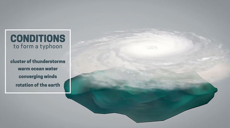
Why the Delay?
Meteorologists point to a mix of thermal and atmospheric dynamics suppressing cyclone formation:
Cooler-than-normal sea surface temperatures in the tropics have reduced the energy available for typhoon development. The ocean is warming slower than usual, partly due to recurring cold air outbreaks causing upwelling, cool water rising from deeper layers.
A dominant subtropical high has lingered over the Northwest Pacific, positioned farther north than usual. This system creates strong downward air movement, which stifles the storm-forming convection needed for cyclones to take shape.
The result: a region-wide atmospheric pattern that’s effectively shut down typhoon development, at least for now.
Environmental and Agricultural Effects in Hainan

While the lack of typhoons means fewer interruptions in the early agricultural calendar, it also disrupts the natural balance Hainan relies on.
Water stress is an emerging issue. Typhoons are a key source of rainfall for reservoirs and farmland. With no storms in sight, the island is seeing a growing deficit in precipitation. This could become critical if the dry stretch continues deeper into summer.
Pest and disease pressure is also on the rise. High humidity and stagnant air, unchecked by storm-induced cooling and ventilation, are ideal for insects and crop diseases. Farmers may face rising costs in pest control and a greater risk of yield losses later in the season.

The Risks Ahead
A late start doesn’t guarantee a quiet season. Historical data shows that some years with delayed beginnings can end with average or above-average typhoon activity. And the longer the lull, the greater the potential for rapid, intense storm formation when conditions finally shift.
For Hainan, this raises concerns about sudden drought-to-flood transitions
Dry soil followed by heavy rainfall increases the risk of flash flooding and urban runoff. Agricultural areas may struggle with waterlogging if drainage systems are unprepared.
Hainan’s extended calm is an outlier, one that offers short-term relief but raises questions about what comes next. As the region enters the peak typhoon months of July to October, the focus must now shift to readiness. If and when storms arrive, they could hit harder and faster than usual.
Related article: How does a typhoon form?