Hainan’s next transport network may not be built entirely on the ground.
The province’s new 2026–2030 comprehensive transport plan sets out a network of general aviation airports, vertical take-off and landing facilities and designated low-altitude routes intended to carry traffic through the airspace between conventional aviation and the roads below.
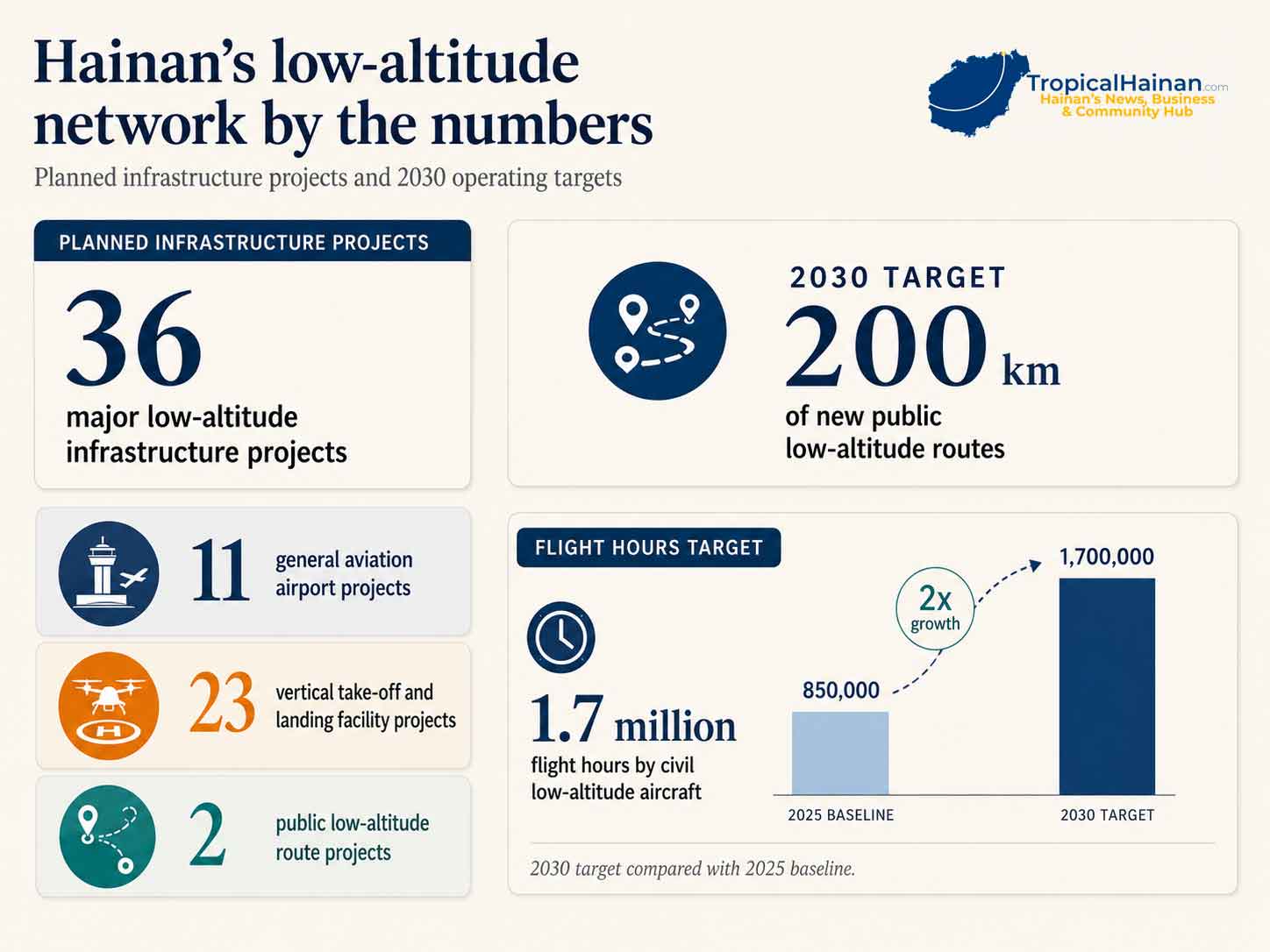
The plan identifies 36 major low-altitude infrastructure projects: 11 general aviation airport projects, 23 vertical take-off and landing facility projects and two public low-altitude route projects. By 2030, Hainan is targeting 200 kilometres of new public low-altitude routes and 1.7 million flight hours by civil low-altitude aircraft, up from 850,000 hours in 2025.
But what will the network actually look like?
The aircraft involved could range from relatively conventional helicopters and small general aviation aircraft to cargo drones and a new generation of electric aircraft capable of taking off vertically. Some could carry packages. Others could be used to inspect offshore infrastructure, monitor forests or support emergency work. Eventually, some could carry passengers across the Qiongzhou Strait.
Some of that is already happening although most of it is still a plan.
What exactly is Hainan planning?
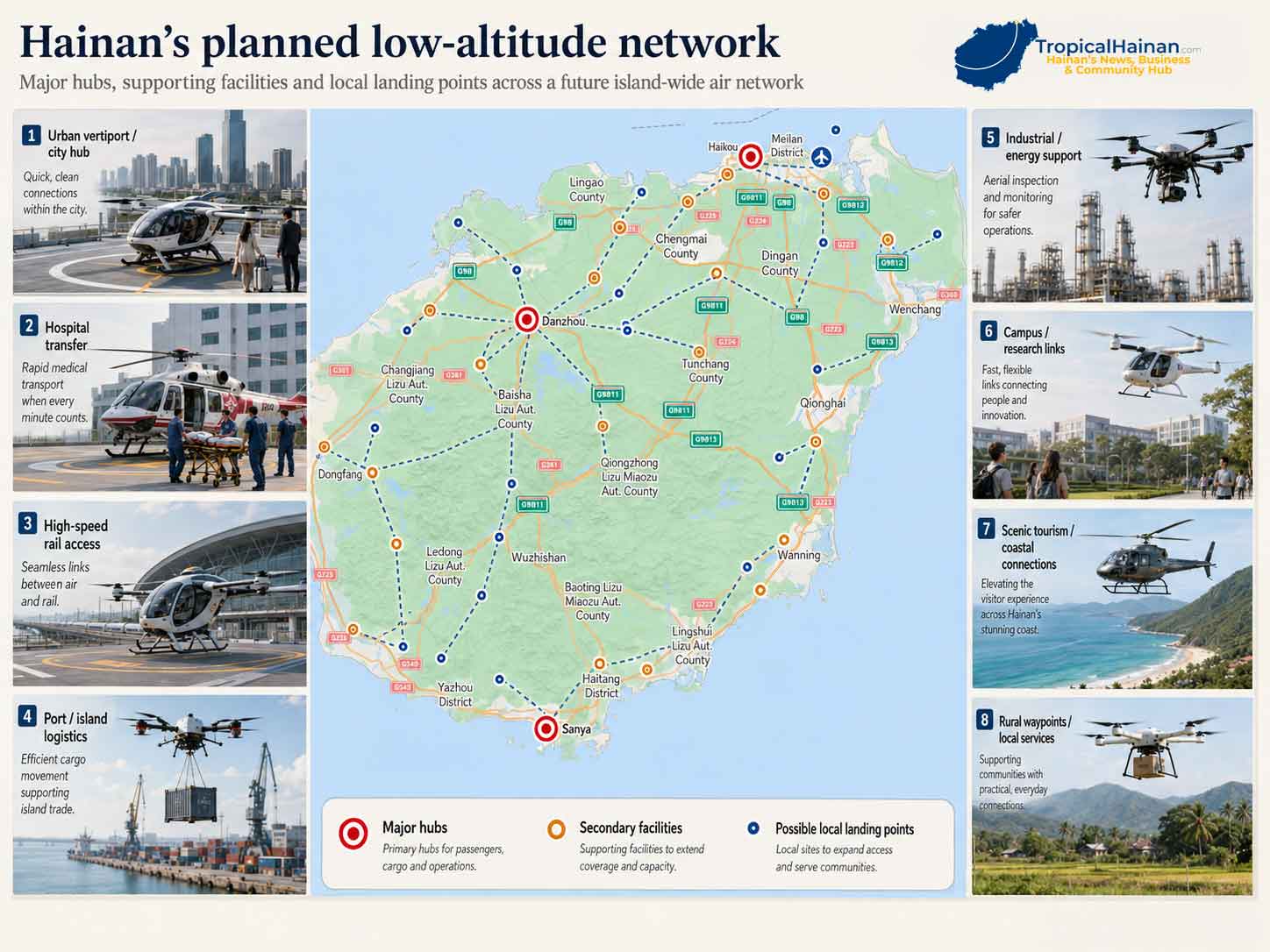
Hainan describes the future low-altitude network as a combination of general aviation airports, landing points, air routes and a support network. The transport plan calls for three first-tier vertical take-off and landing facilities in Haikou, Sanya and Danzhou, along with 20 second-tier facilities across the province.
The plan also allows further third-tier facilities to be built where needed at high-speed railway stations, airports, wharves, waystations, schools, hospitals, tourist attractions, roadside locations, industrial parks and elsewhere.
None of that means a flying-taxi terminal is about to appear outside a Hainan school, the plan doesn’t suggest that every site will carry passengers.
What is VTOL, and what will these aircraft look like?
VTOL simply means vertical take-off and landing.
A helicopter is a VTOL aircraft. So is a large multicopter drone. The term describes what an aircraft can do rather than what it looks like.
The newer term eVTOL adds one important distinction: the aircraft uses electric propulsion.
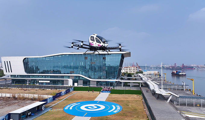
Some eVTOLs look much like oversized drones, with a passenger cabin surrounded by multiple rotors. China’s EH216-S, for example, is battery powered and uses eight pairs of rotors. CAAC granted the aircraft its type certificate in 2023, followed by a production certificate in 2024.
Other designs look more like small aeroplanes. They rise vertically using dedicated lift rotors, then use wings and forward propulsion once airborne.
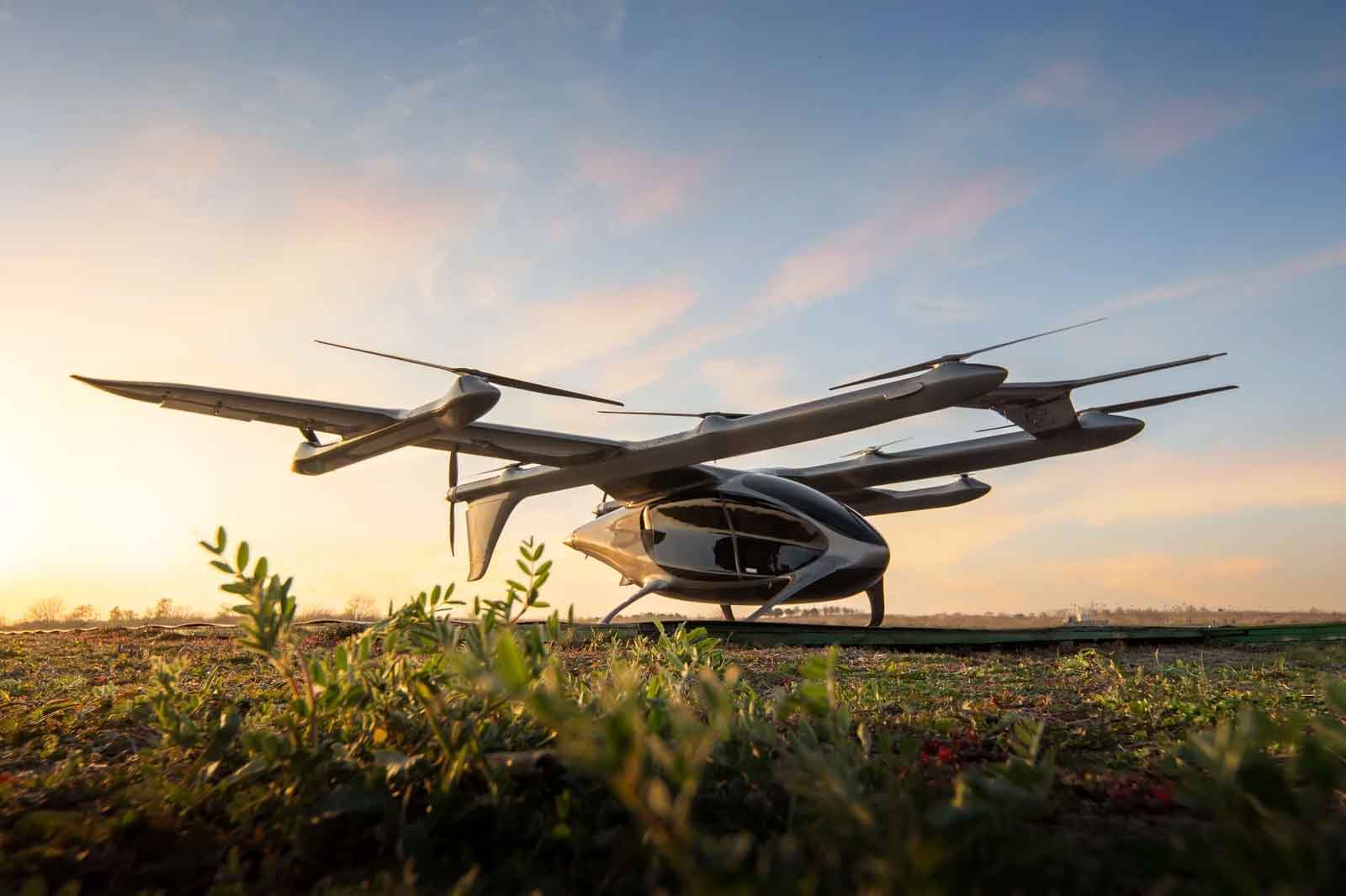
Cargo versions are also becoming much larger. AutoFlight’s Kaiyou, which has already flown across the Qiongzhou Strait, is an unmanned eVTOL with a two-tonne maximum take-off weight and a manufacturer-stated payload of up to 400 kilograms. It takes off vertically but uses wings during forward flight.
What could you actually see flying over Hainan?
Probably not fleets of air taxis, at least initially.
Hainan’s plan identifies low-altitude operations covering cross-sea transport and inter-island drone logistics, alongside exploratory work on offshore wind-farm inspection, offshore oil and gas platform monitoring and marine-resource exploration.
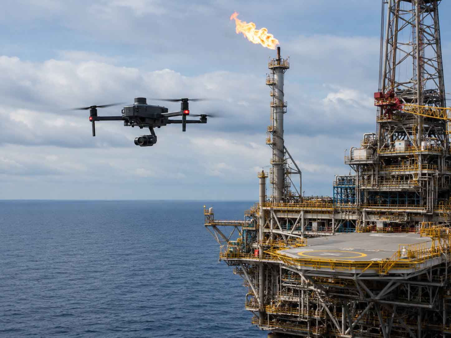
It also calls for pilot schemes in agricultural spraying, rainforest patrols and rocket-launch monitoring.
Tourism is part of the plan as well, including low-altitude sightseeing, skydiving and aviation events.
A drone flying offshore could be inspecting a wind turbine rather than delivering a parcel. An aircraft operating around Wenchang could support launch monitoring. Another could be carrying urgent freight between islands. Smaller aircraft may eventually be used around farms, ports or industrial facilities.
Cargo is arriving before passenger air taxis
The clearest example comes from the Qiongzhou Strait.
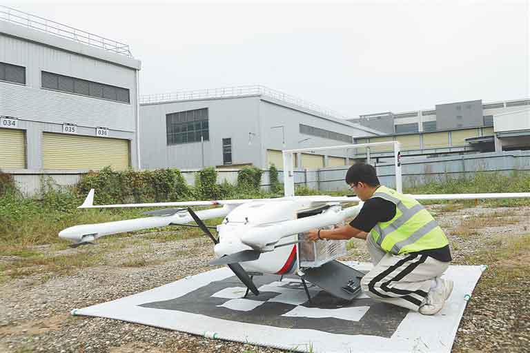
On 1 December 2025, a regularised low-altitude drone logistics route was launched between Xiuying in Haikou and Xuwen in Guangdong. Reporting on the launch said the inaugural crossing took 19 minutes, cutting almost five hours from the conventional logistics journey.
What the route demonstrates is that low-altitude aviation can address a very specific Hainan problem: moving small quantities of time-sensitive goods across a body of water that otherwise requires ferry transport.
In other words, the drone does not have to replace a truck. It could become one part of a larger logistics chain.
Flying across the Qiongzhou Strait
Cargo is not the only use being tested.
On 31 December 2025, two very different electric aircraft crossed from Haikou to Xuwen in technology demonstrations.
AutoFlight’s unmanned Kaiyou cargo eVTOL flew about 23 kilometres from Haikou’s Mingzhu Island to Xuwen Port in nine minutes.
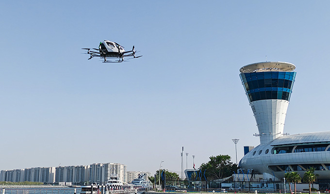
A passenger-capable EHang EH216-series aircraft also completed a point-to-point cross-Strait flight that day. These were demonstration and validation flights, not scheduled passenger services.
The new Hainan transport plan puts a cross-Strait low-altitude corridor into the province’s formal infrastructure programme.
It still does not mean a passenger service has been approved, but passenger movement across the Strait is now part of Hainan’s stated long-term transport direction.
Could ordinary people eventually travel this way?
Technically, passenger eVTOL aviation has already moved beyond the prototype stage in China.
The EH216-S has received a CAAC type certificate, production certificate and standard airworthiness certification. In March 2025, the first operating certificates for passenger-carrying civil unmanned aircraft were issued to two operators using the EH216-S.
The more interesting point is that the aircraft, regulatory framework, demonstrations and proposed route infrastructure are now developing at the same time.
Where will all these aircraft take off and land?
A low-altitude transport network needs more than concrete pads.
Hainan’s plan includes communications, navigation, surveillance and meteorological systems alongside the physical landing infrastructure. It also calls for a provincial intelligent low-altitude network to support monitoring and operations.
What an individual facility will look like will depend on what it is designed to do.
A passenger facility could require landing areas, charging infrastructure and controlled access. A logistics site could have different requirements. A point serving emergency services, industrial inspection or small drones may look nothing like an airport.
How high will they fly, and how noisy will they be?
There is no single published altitude at which Hainan’s future low-altitude network will operate.
Under China’s current unmanned-aircraft regulations, airspace above 120 metres true height is generally treated as controlled airspace for unmanned aircraft, along with areas around airports, ports, major infrastructure and other sensitive locations. Outside those controlled areas, the sub-120-metre category applies to micro, light and small drones rather than providing a general operating band for larger aircraft.
Noise is similarly difficult to reduce to one number. Electric propulsion removes the conventional helicopter engine, but eVTOL aircraft still use rapidly rotating propellers or rotors and are not silent.
For residents, the eventual impact will depend as much on routes, frequency, altitude and the location of landing sites as on the aircraft itself.
What happens in Hainan’s thunderstorms and typhoons?
This is one of the less discussed questions, but for Hainan it may be one of the most important.
Aircraft operating at low altitude still have to deal with wind, heavy rain, thunderstorms, lightning and the rapidly changing Hainan weather. The Hainan plan explicitly includes meteorological infrastructure as part of the proposed low-altitude route network.
It means a future service would need operating limits, weather monitoring and procedures for the days when flying is not practical. A transport system that works well on a clear December morning still has to prove how reliably it can operate through a Hainan summer.
The technology already exists. The network does not
Hainan is not starting from zero.
What Hainan does not yet have is the network described in the new five-year plan.
The three first-tier VTOL facilities in Haikou, Sanya and Danzhou remain planned. The 20 second-tier projects have not been publicly located in detail. Additional third-tier facilities are to be developed according to needs.
The new transport layer is unlikely to arrive all at once. It is more likely to appear piece by piece: another cargo route, an inspection operation offshore, a new landing site, more demonstration flights, dedicated corridors and eventually passenger services if the technology, regulation and economics support them.
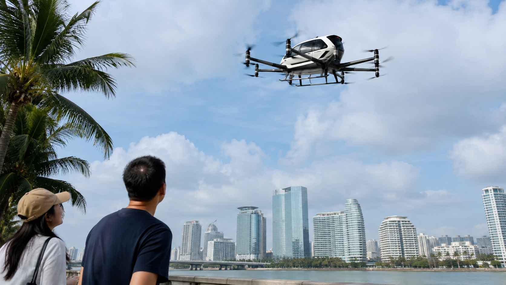
For most people in Hainan, the first sign may not be an air taxi.
It may simply be looking up and realising that some of the island’s traffic is no longer travelling only on the road.
Related article: Where Can You Fly Direct From Haikou in 2026?