

The tropical disturbance east of the Philippines strengthened into a tropical depression on the afternoon of September 1st. It is expected that the depression will gradually intensify and may develop into a typhoon within the next 12 hours, reaching a Maximum Strength of Level 14, potentially entering the northern part of the South China Sea around the 5th of the month.
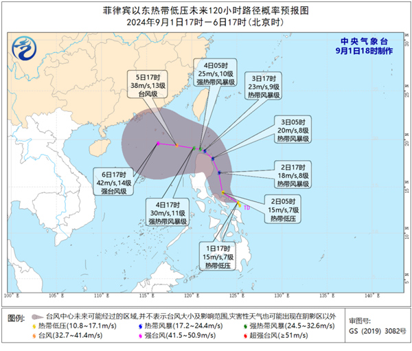
As of 5:00 PM on the 1st of September, its centre was located approximately 470 kilometres southeast of Manila in the Philippines. The maximum wind force near the centre was at level 7 (15 m/s), with the central minimum pressure at 1002 hPa.
The depression is expected to move north-westward at a speed of 15-20 kilometres per hour, gradually intensifying.
It is expected to strengthen into a typhoon within the next 12 hours, starting to turn towards the west-northwest direction on the 3rd, and entering the northern part of the South China Sea around the 5th, with further intensification to a typhoon or strong typhoon level (38-45 m/s, levels 13-14).
Related article: Where do birds go in a typhoon?