
According to the Central Meteorological Observatory, Typhoon “Yinxing” formed early on November 4th in the northwest Pacific, this is the 22nd typhoon of the year.
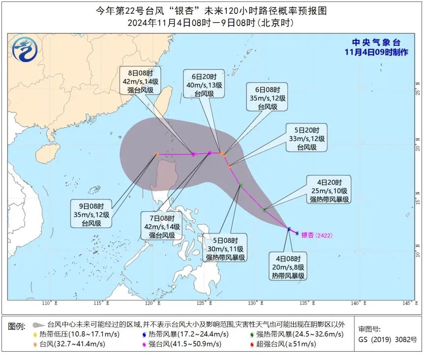
As of 8:00 a.m. on November 4th, typhoon Yinxing’s center was approximately 1,350 kilometers southeast of Manila, Philippines, located at 12.1°N latitude and 133.2°E longitude. Winds near the center have reached level 8, with speeds up to 20 meters per second (approximately 72 km/h), and the central pressure is measured at 1000 hPa. The radius of level 7 winds extends 180 kilometers from the center.
The typhoon is expected to continue moving northwest at a speed of 25-30 kilometers per hour and is forecast to intensify as it approaches the waters east of the Philippines.
Weather Analysis and Future Trajectory
Over the next three days, Yinxing is forecasted to track northwestward and strengthen due to the influence of warmer sea temperatures.
Click HERE for typhoon tracker
The typhoon’s exact path remains uncertain beyond this period. Both a westward trajectory into the South China Sea and a possible northward turn remains viable scenarios, though most current models indicate a westward path. Continued monitoring will be essential as conditions evolve.
Haikou Weather Forecast
Although the impact of Typhoon Yinxing on Hainan is currently uncertain, the Haikou Meteorological Observatory has issued the following forecast for the coming days:
- November 5: Cloudy conditions with light, scattered showers.
- November 6: Partly cloudy skies are anticipated.
Marine Conditions in the Qiongzhou Strait
The Qiongzhou Strait, located between Hainan Island and mainland China, is forecasted to experience heightened winds from November 5 to 6. Northeast winds are expected to reach level 5-6, with gusts of up to level 7-8, adding to the area’s unsettled weather conditions.
Haikou authorities and residents are advised to stay informed about any updates as Typhoon Yinxing progresses.
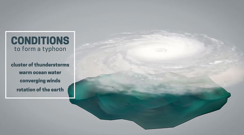
Related article: How does a typhoon form?