A tropical depression has formed over Central South China Sea and is expected to strengthen on the 9th into the 7th Typhoon of the year.
The Hainan Provincial Meteorological Bureau issued a typhoon level four warning at 17:10 on August 8th, stating that strong winds and heavy rain are expected across the province.
According to the bureau, the tropical depression in the central part of the South China Sea was generated at 14:00 on August 8th, with a maximum wind force of level 7 (16 m/s) near the centre.
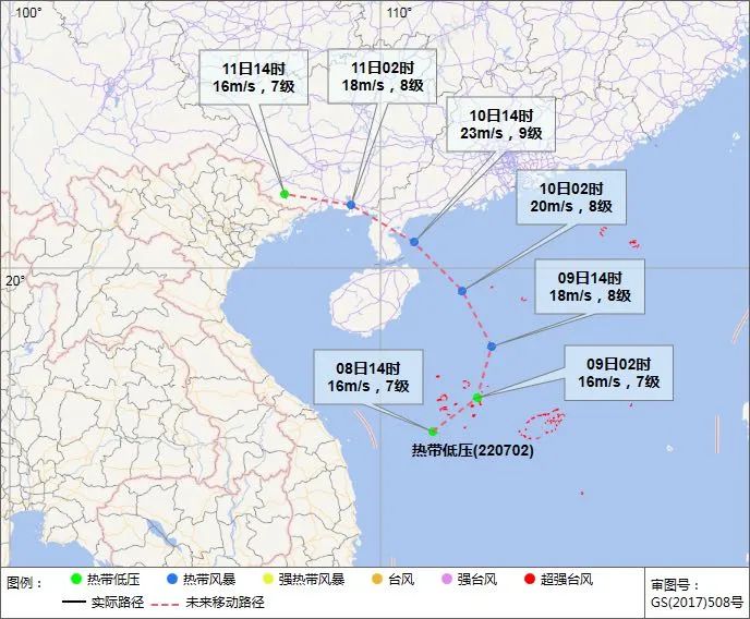
At 14:00, its centre was located at 15.6 degrees latitude north and 111.4 degrees longitude east. It is located in the middle of the South China Sea, about 170 kilometers southwest of Sansha City (Xisha Yongxing Island).
The Hainan Provincial Meteorological Observatory predicts that the tropical depression will first circulate in the central and western waters of the South China Sea, with little change in intensity.
It will begin to move in a northerly direction on the 9th, and its intensity will gradually strengthen.
It may strengthen to the 7th typhoon this year on the 9th, with a maximum intensity of tropical storm level (8-9, 20-23 m/s) and will affect from the northeast coast of Hainan Island to western Guangdong from the afternoon to the evening of the 10th.
Related article: Where do birds go in a typhoon?